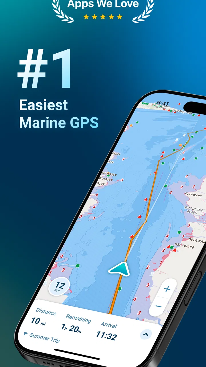
Wavve Boating: Marine Boat GPS
- 4.5
- Rating
- 500.00K
- Installs
- Free
- Price

 Analysis by App-foxy
I spend a lot of time thinking about navigation apps in terms of what happens when the screen matters most: approaching an unfamiliar harbor, checking a route before leaving shore, or trying to understand changing conditions without juggling several separate tools. Wavve Boating is built for that kind of use. It is a free Maps & Navigation app from Wavve Boating that brings marine charts, GPS navigation, weather, tides, water information, and depth details into one boating-focused workspace.
That focus immediately separates it from ordinary road-navigation apps. A driving app is excellent at roads, turns, traffic, and addresses, but it is not designed around waterways. Wavve Boating feels aimed at people who need a clearer picture of what is happening around a boat rather than simply a line to follow. I found that difference most useful before a trip, when planning and checking conditions are just as important as following the route.
The app is available at no charge, with optional in-app purchases ranging from $0.99 to $69.99 per item. It is rated for Everyone, so its presentation is approachable even if the subject itself requires responsible judgment. Its average rating is 4.6 from around 4.6 thousand ratings, and it has passed 100 thousand installs. Those figures suggest a healthy audience without making the app feel like a mass-market replacement for every navigation tool.
You May Also Like

 Blood Strike: 2.5 Anniversary
Blood Strike’s Loadouts Turn Every Drop Into a Tactical Gamble
A close look at Blood Strike’s custom loadouts: how fast access to signature weapons reshapes its battle royale rhythm, rewards preparation, and narrows the gap between fights.

 Pandora - Music & Podcasts
Pandora’s Music Is Easy to Start, but Harder to Recover
Pandora’s strength is its low-effort path from a seed to a station. Its weak spot is how much confidence it asks you to place in connection, setup, and quiet recovery.

 8 Ball Pool
 Is Built on Rivalries, Rematches, and Routine
A close look at the rivalries, rematches, shared routines, and unanswered safety questions that turn a quick pool match into a persistent mobile community.

 Samsung Music
’s Quiet Strength Is Playing What You Already Own
Its reach comes less from spectacle than from dependable access to a personal library. That simplicity is both the app’s strongest retention engine and its ceiling.

 AccuWeather: Weather Radar
AccuWeather Review: A Quick, Clear Forecast for Everyday Decisions
For everyday plans, the best forecast is the one you can understand quickly. AccuWeather makes rain timing, radar, and local conditions easy to act on, with a few trade-offs.

 Hill Climb Racing
Why Hill Climb Racing Still Turns Crashes Into One More Run
A tiny car, a bumpy hill and one more upgrade: Hill Climb Racing keeps resurfacing because its simple chaos makes every near-miss feel personal.
More From Our News Desk



How Wavve Boating feels during real navigation
I find the most useful way to judge Wavve Boating is to look beyond whether the map is easy to open and ask whether it helps me make one decision at a time. Before heading out, I would settle the route and check the relevant conditions while safely at the dock, then keep the chart view focused on orientation underway. That distinction matters most when several kinds of information could compete for attention.
Speed expectations before leaving shore
My first impression is that this is an app to prepare with, not something I would open for the first time while already dealing with a complicated maneuver. The useful question is not only whether a map appears quickly, but whether the information I need is arranged in a way that reduces hesitation. Marine navigation has more context than a simple destination search, and the chart, position, weather, tide, water, and depth elements all serve different decisions.
When I use a boating app, I want to make the route familiar before the boat moves. That habit is especially important here because a chart-based interface asks me to interpret the surroundings rather than follow a sequence of spoken road instructions. I would check the general area, inspect the route, look at relevant conditions, and only then rely on the phone during the trip. This workflow makes the experience feel faster in practice because I am not trying to learn the interface at the same time as I am navigating.
The current version is 5.4.8, and the app supports devices running Android 9 or later. That is a useful compatibility range for many phones, although anyone using an older handset should check the operating system before planning around it. A supported device is only the starting point, of course. Screen brightness, battery condition, GPS reception, and exposure to sun or water can have a bigger effect on an outing than the app itself.
I would not judge its speed solely by how quickly a screen opens. A marine chart is valuable because it contains a lot of visual context, and rushing through that information would not necessarily improve safety. The better measure is whether the app lets me move from broad planning to a useful view without unnecessary confusion. In that respect, the boating-specific layout is more relevant than the kind of instant, turn-by-turn response expected from a city driving app.
What happens when the workload becomes heavy
The demanding moments are easy to identify. A busy harbor, an unfamiliar shoreline, a route that crosses several water areas, or a trip planned around tide and weather information can make the screen feel much more important than it does during casual map browsing. This is where I would keep my expectations realistic: the app can organize information, but it cannot remove the need to look outside, understand local conditions, or use proper onboard equipment when the situation calls for it.
A practical example would be a weekend trip to a harbor I have not visited before. Before departure, I would use the app to examine the marine chart and understand the surrounding water, then review weather and tide information as part of the preparation. Once underway, I would keep the map view available for orientation rather than repeatedly changing screens. Near the destination, I would slow down mentally as well as physically, using the chart as one source of awareness while relying on visual observation and normal boating judgment.
That workflow reveals one of the app’s strongest ideas: combining related information can reduce the need to remember which separate app contains which detail. Switching between a general map, a weather app, a tide reference, and a dedicated GPS tool can create friction, especially when attention is limited. Wavve Boating does not make all boating decisions automatic, but it gives the trip a more coherent information center.
There is also a trade-off. A single app can become visually busy when several kinds of information compete for attention. I would avoid leaving every possible layer or detail active if it makes the chart harder to read. My tip is to decide in advance what the current task is. For route planning, prioritize the chart and depths. For departure timing, focus on weather and tides. For movement, keep the view clean enough that position and surroundings remain easy to interpret.
Reliability is more than a stable screen
A navigation app earns trust through consistency. I want the map to behave predictably, the position to remain understandable, and the information to support decisions without encouraging false confidence. Wavve Boating’s marine focus gives it a sensible role in that process, but I would still treat it as an aid rather than the only source of navigation truth.
That distinction matters because a phone is not the same as a dedicated marine navigation system. Reception can change, the display can become difficult to see in bright conditions, and battery life may be limited on a long trip. None of those concerns make the app useless; they simply define the responsible way to use it. I would begin with a charged device, prepare the route while stationary, and keep a backup plan appropriate to the boat and the trip.
Recovery is another practical concern. If the app is interrupted, I would rather reopen it at a calm moment than depend on a hurried restart during a close maneuver. The safest habit is to remember the general route and surroundings instead of assuming the phone will always recover exactly where I left it. In other words, the app can improve awareness, but the operator should remain capable of continuing safely if the screen becomes unavailable.
I also appreciate that the app’s Everyone rating makes it approachable for families and casual users, but that should not be confused with beginner-level responsibility. A simple interface can help a new boater understand a map, yet it cannot replace learning chart symbols, local regulations, navigation practices, or the meaning of changing water conditions. I would recommend it as a learning companion and planning tool, not as a shortcut around boating knowledge.
Device constraints that affect the experience
The Android 9 minimum requirement is modest, but older compatible phones may still offer a less comfortable experience than newer devices. A larger display is helpful when examining a chart because it reduces the need to zoom and pan repeatedly. At the same time, a large phone can be awkward to secure on a small boat, so the ideal device is a compromise between readability, mounting, visibility, and protection.
Battery demand is another consideration. Navigation, GPS use, a bright screen, and mobile connectivity can all consume power during a trip. I would not wait until departure to discover that the phone is already low. A power bank or suitable onboard charging arrangement is sensible, and the phone should be positioned where it can be seen without becoming a distraction. The app may be free to install, but a reliable boating setup still involves practical equipment outside the app.
Storage and connectivity also shape expectations. I would prepare the app and inspect the area before leaving rather than assume that every part of a route will offer the same connection quality. Even when a phone appears to have a signal, conditions on the water can change. The more remote the trip, the more important it becomes to treat the app as one layer of preparation instead of the complete navigation system.
Purchases deserve attention as well. The free entry point makes it easy to try the basic experience, while the optional items can add meaningful cost depending on what a user chooses. I would explore the free version first and decide whether the app fits my style of boating before paying for extras. Someone who only takes occasional short trips may have different needs from a frequent boater who wants a more complete planning setup.
Where it beats ordinary alternatives
Compared with a standard road map, Wavve Boating is the obvious better fit for water-based planning because it speaks in the language of marine navigation. A generic map may show coastlines and locations, but it is not organized around the same questions a boater asks: What is beneath the route? How do tides affect timing? What weather information should I consider? Where am I in relation to the surrounding water?
Compared with separate specialist apps, the main advantage is continuity. I do not have to build the entire trip from disconnected screens. That can make the preparation process calmer and reduce the chance of forgetting a relevant check. The compromise is that a dedicated weather, tide, or onboard navigation product may offer deeper specialization for a particular task. If my priority is highly detailed professional navigation, I would compare Wavve Boating with the equipment and services already used on the boat rather than replacing them automatically.
Compared with paper charts, the app is more convenient for quickly checking position and changing the visible area. Paper remains valuable as a backup because it does not depend on battery or a phone screen. I see the strongest setup as layered: use the app for accessible planning and live orientation, while keeping the level of backup appropriate to the distance, weather, vessel, and experience involved.
Small habits that make the app more useful
One useful habit is to plan in two passes. First, I look at the route broadly and identify the important areas around it. Then I return to the same route with a narrower question, such as depth, timing, or weather. This prevents me from trying to evaluate everything at once and helps reveal whether a route that looks simple on a wide view needs closer attention.
A second habit is to use the app before the trip as a rehearsal tool. I can become familiar with the visual shape of the coastline, the destination area, and the route direction while sitting safely at home or at the dock. That familiarity matters because it leaves more attention available for the real environment later. It is a subtle advantage over opening a map only when I am already moving.
A third is to separate information from authority. The app can show useful marine context, but I still need to interpret it responsibly. If weather changes, visibility drops, or the boat behaves differently from expected, I would change the plan rather than insist on following the screen. This is the most important trade-off in any phone-based navigation tool: convenience improves awareness, but convenience must never become overconfidence.
I would also keep the interface task-specific. If I am checking departure timing, I do not need to stare at every chart detail. If I am approaching a shallow or unfamiliar area, I would give the chart and depth information more attention and reduce distractions. This simple discipline makes the app feel less like a collection of features and more like a practical instrument used for one decision at a time.
Who should use it and who should skip it
I think Wavve Boating is a strong match for recreational boaters, anglers, sailors, and families who want marine-focused information without assembling several unrelated tools. It is especially appealing to someone who plans trips on a phone, wants chart and condition information in one place, and values a gentler entry point than a complex professional system.
It is less suitable as the sole navigation solution for demanding offshore work, serious commercial operations, or any trip where a phone would be an inadequate primary device. Experienced users who already have a dedicated marine chartplotter and a carefully chosen collection of specialist tools may find the app most useful as a secondary planning reference rather than a replacement.
I would also hesitate to recommend relying on it to someone who dislikes preparing in advance. The app rewards users who inspect the route, understand the conditions, keep the device ready, and maintain backup awareness. If the goal is simply to tap a destination and follow automatic instructions without learning the water around it, a road-navigation mindset will not transfer well here.
My performance verdict after weighing the trade-offs
Wavve Boating succeeds because it treats boating as more than moving a location marker across a generic map. Its combination of marine charts, GPS positioning, weather, tides, water information, and depths gives me a more relevant starting point for planning and orientation than an ordinary navigation app. The free price makes trying it straightforward, while the optional purchases mean I would still examine the upgrade path carefully before committing.
In terms of perceived speed, I value its focused workflow more than a race to load a screen. During heavy-use moments, its biggest strength is the ability to keep related boating information close together; its biggest weakness is that a busy display or an unprepared user can still create confusion. For stability and recovery, I would use it with sensible device preparation and a backup plan, because no phone app should be treated as immune to battery, reception, or hardware limitations.
The app feels most convincing when used before departure and during ordinary recreational navigation, where it can improve awareness without pretending to replace judgment. Its current version, 5.4.8, supports Android 9 and later, and the broad Everyone rating makes it approachable for many households. Still, the responsibility remains with the person operating the boat, not the screen.
My recommendation is simple: try Wavve Boating if you want a boating-specific planning and navigation companion that brings several useful categories of information together. Prepare with it, keep the view uncluttered, protect the phone from the realities of the water, and maintain an appropriate backup. Used that way, it is a practical and focused choice for recreational boaters, even though professionals and demanding offshore users may reasonably prefer dedicated marine equipment as their primary system.
FAQs for Wavve Boating: Marine Boat GPS
01What features does Wavve Boating: Marine Boat GPS offer?
Wavve Boating provides real-time GPS navigation tailored for marine environments. It includes detailed nautical charts, customizable depth settings, and community-sourced points of interest. Users can also share locations and routes with friends. The app’s interface is user-friendly, making it suitable for both seasoned mariners and newcomers to boating.
02Is Wavve Boating available for both Android and iOS devices?
Yes, Wavve Boating is available for both Android and iOS platforms. Users can download the app from the Google Play Store for Android devices and the Apple App Store for iOS devices. It ensures compatibility with a wide range of smartphones and tablets, providing seamless navigation experiences across devices.
03Does Wavve Boating require an internet connection to function?
Wavve Boating primarily uses GPS, which does not require an internet connection. However, downloading charts and accessing some community features may need internet access. It’s recommended to download necessary data before heading out to ensure uninterrupted service, especially in areas with poor network coverage.
04How does the community feature work in Wavve Boating?
The community feature in Wavve Boating allows users to share and receive information about routes, hazards, and points of interest from other boaters. This collaborative approach enhances navigation safety and enriches the user experience by providing real-time updates and recommendations from fellow mariners.
05Is there a cost associated with using Wavve Boating?
Wavve Boating offers both free and premium subscription options. The free version includes basic features, while the premium subscription unlocks advanced functionalities such as offline charts and enhanced community interactions. Pricing details and package options are available within the app, catering to different user needs and preferences.
Pros
- User-friendly interface for easy navigation
- Accurate GPS tracking for marine routes
- Offline maps available for remote areas
- Real-time weather updates for safety
- Customizable waypoints for personalized trips
Cons
- Limited free features in the basic version
- Occasional lag in high-traffic areas
- Battery drain due to continuous GPS use
- Requires internet for some features
- Some charts need frequent updates

Wavve Boating: Marine Boat GPS
Gallery